2016 Hurricane Matthew
Estimated storm surge and significant wave heights caused by the hurricane, focusing on the timing of its landfall on Haiti
Summary: Although storm surge produced by the Hurricane Matthew was not too significant compared to some of the recent historical events such as the 2013 Typhoon Haiyan in the Philippines, extremely large waves, estimated 10 meters or larger in just offshore of Haiti's south- western coast, extensively battered vulnerable coastal communities.
Note: The present tropical cyclone analysis was tentatively performed by referencing the NOAA Hurricane Matthew forecast/advisory
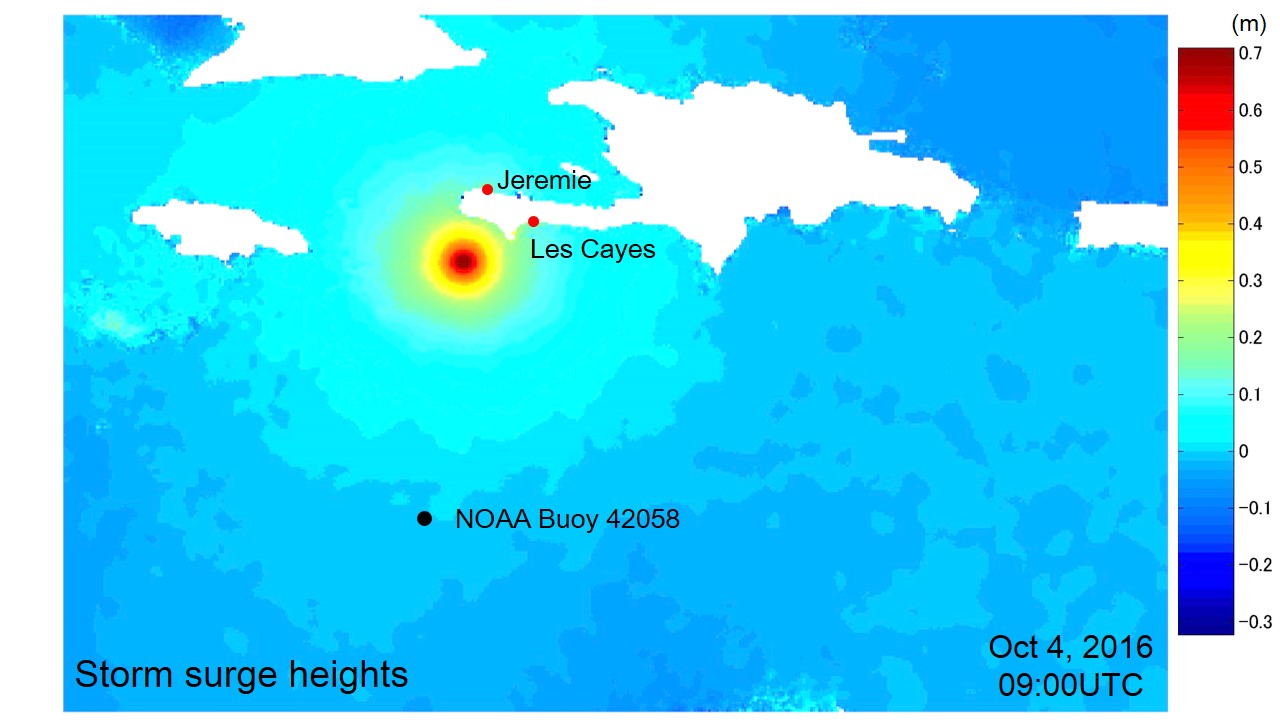
Fig. 1 Distribution of pressure and wind-driven surge, when the hurricane was approaching the south- western tip of Haiti. The size of TC was estimated by the relationship, Rmax = 0.23 R50.
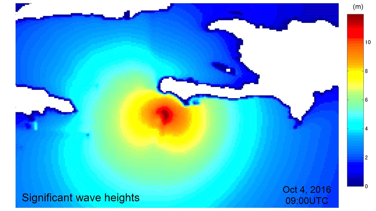
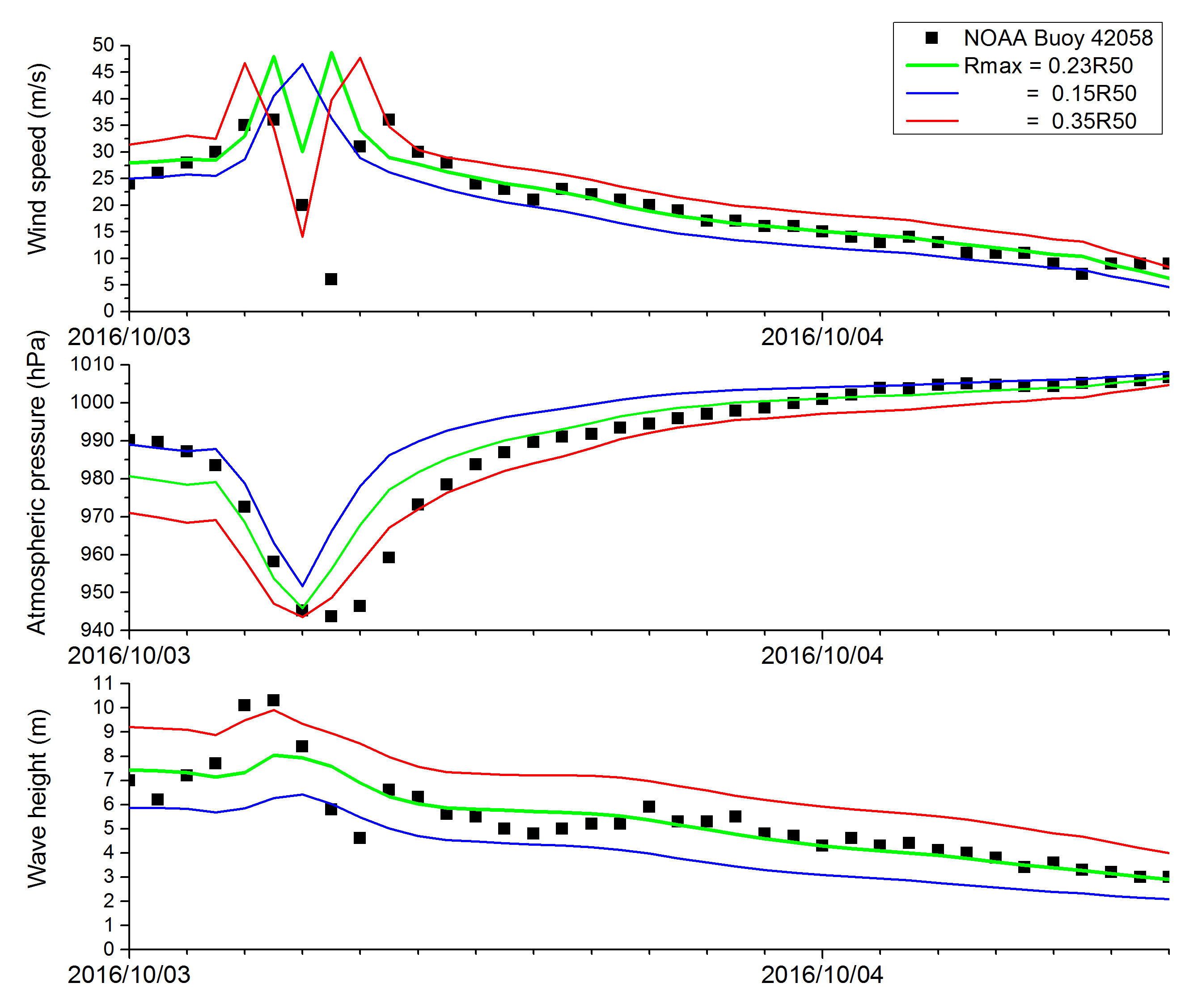
Fig. 3 Simulation results comparing with the data from the NOAA Buoy (Station 42058), which is deployed in Central Caribbean near Kingston, Jamaica
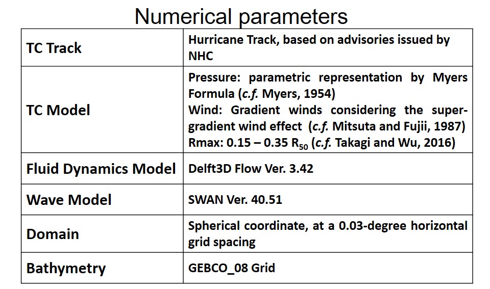
Table. 1 Numerical parameters and models used in the analyis
Myers, V. A.: Characteristics of United States hurricanes pertinent to levee design for lake Okeechobee, Florida, Hydrometeorological Report, US Weather Bureau, No. 32, 106 pp., 1954.
Mitsuta, Y, Fujii T: An Analysis and Synthesis of typhoon Wind over Japan, Bull. Disas. Prev. Res. Inst, Kyoto Univ., Vol.37, Part4, No329, pp.169-185., 1987.